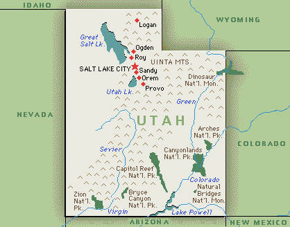
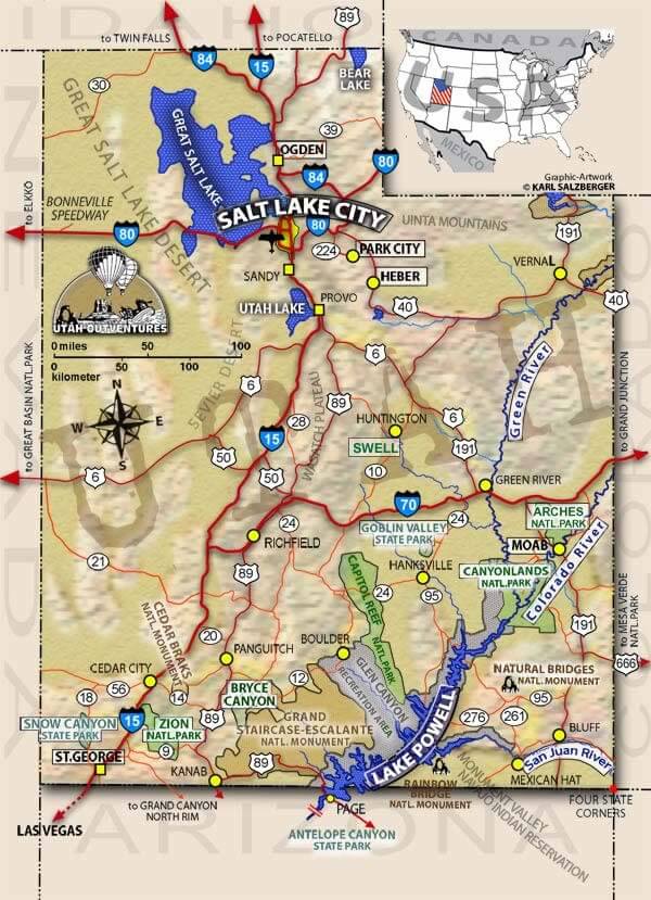
Utah Map
Navigate Utah Map, Utah states map, satellite images of the Utah, Utah largest cities maps, political map of Utah, driving directions and traffic maps.
For all Utah Cities Map
MAP OF UTAH
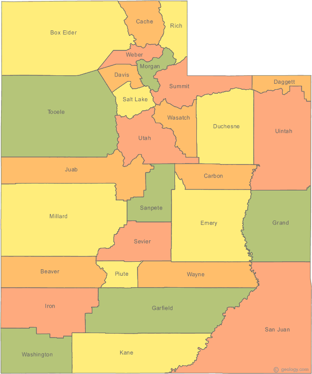
UTAH MAP

A Collection of Utah Maps and Utah Satellite Images
MAP OF UTAH

UTAH COUNTY MAP
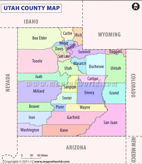
UTAH HISTORICAL MAP

UTAH MAP

UTAH PHYSICAL MAP

UTAH CITIES MAP

UTAH COUNTIES ROAD MAP USA
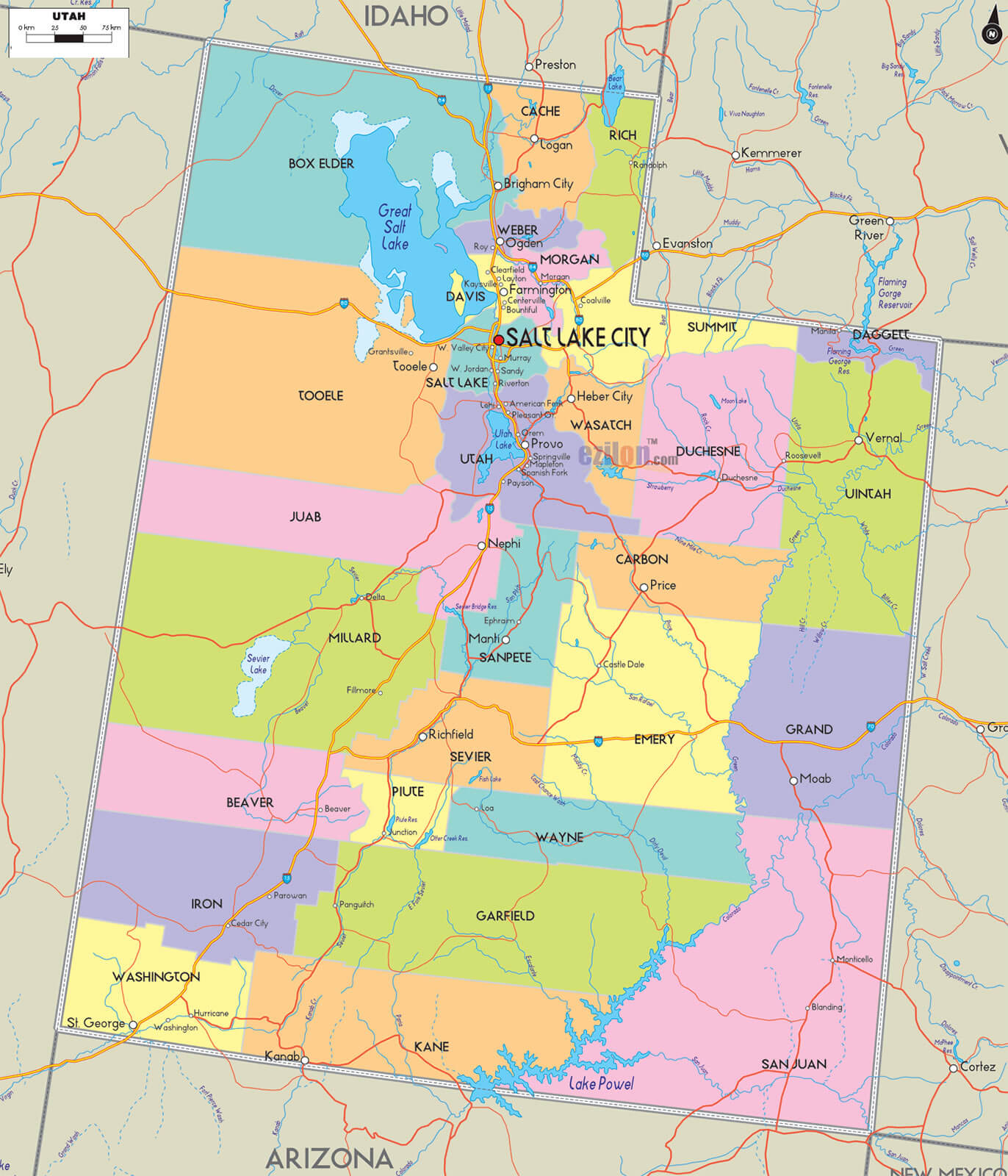
UTAH COUNTRY MAP

UTAH COUNTY MAP
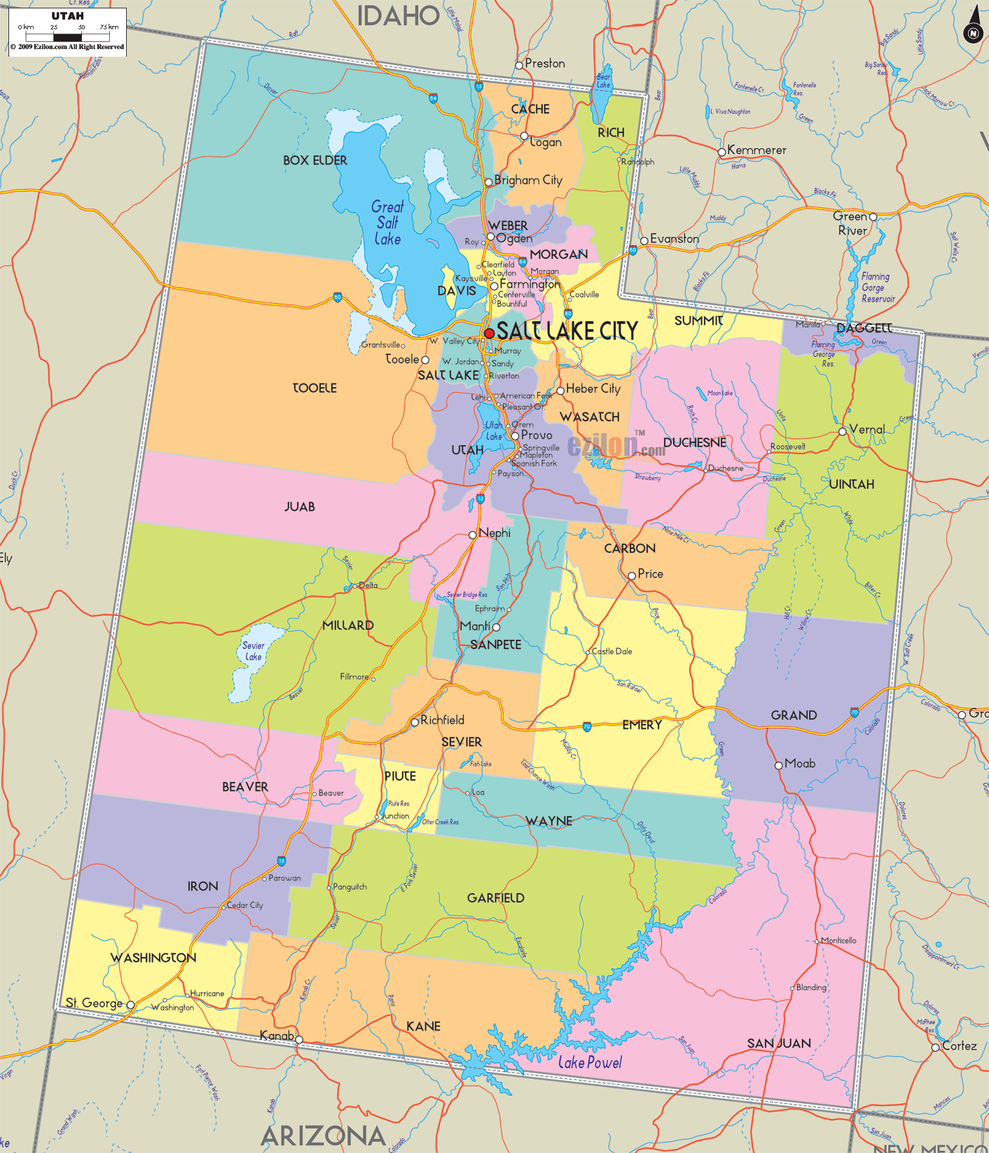
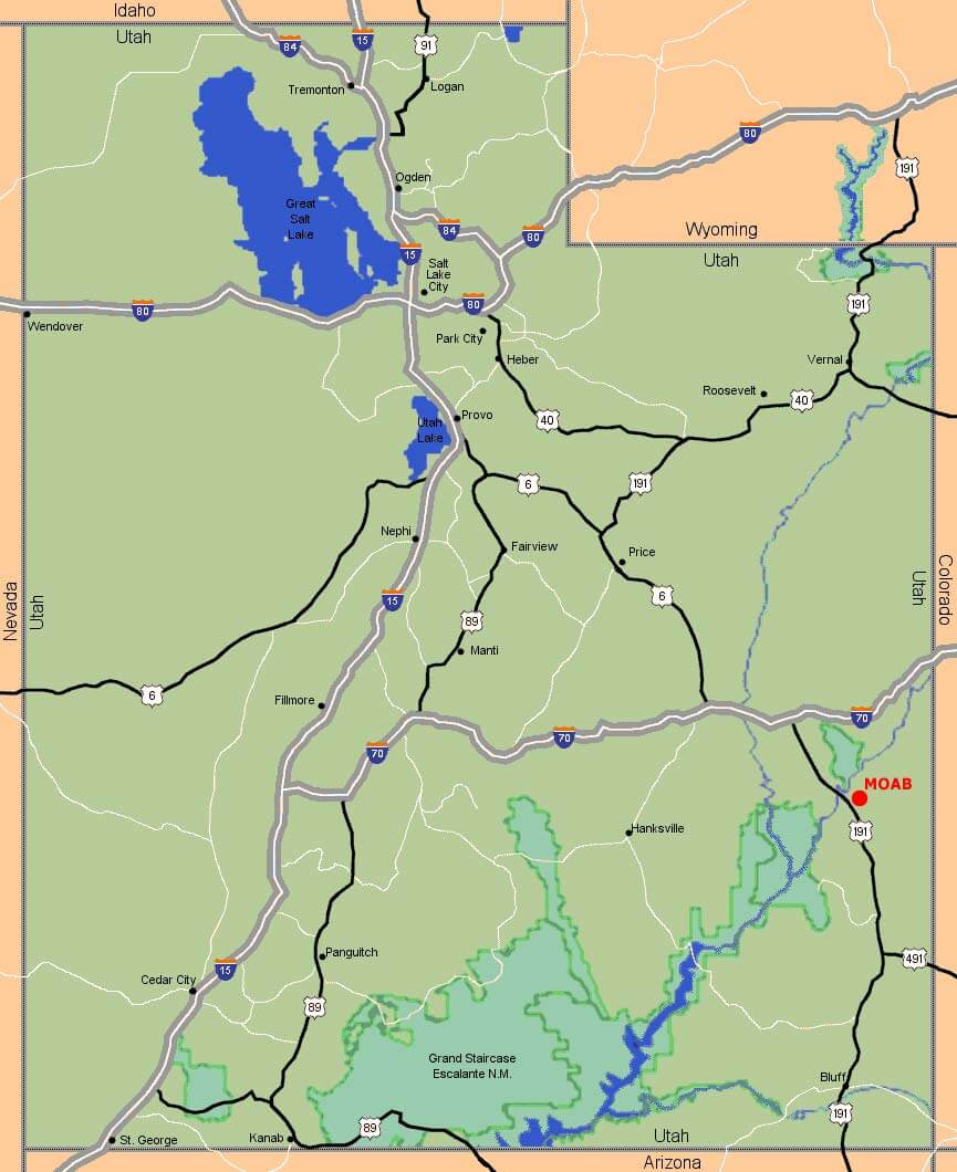
UTAH ELEVATION MAP

UTAH GOLD MAP

UTAH HISTORICAL MAP

UTAH MAP

UTAH MAP GREAT LAKE
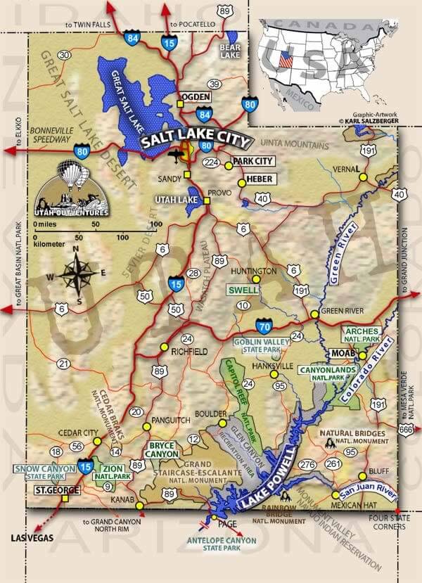
UTAH MAP SALT LAKE CITY

UTAH MAPS

UTAH PHYSICAL MAP

UTAH POLITICAL MAP

UTAH PROMINENCE MAP

UTAH ROAD MAP

UTAH ROUTE MAP

UTAH ROUTE MAP
UTAH SATELLITE IMAGES

A collection of Utah Maps
Largest Cities Map of Utah and Population
Salt Lake City Map - 186,440 West Valley City Map - 129,480 Provo Map - 112,488 West Jordan Map - 103,712 Orem Map - 88,328 Sandy Map - 87,461 Ogden Map - 82,825 St. George Map - 72,897 Layton Map - 67,311 Millcreek Map - 62,139 Taylorsville Map - 58,652 South Jordan Map - 50,418 Logan Map - 48,174 Lehi Map - 47,407 Murray Map - 46,746Copyright GuideofTheWorld.Net 2006 - 2025. All rights reserved. Privacy Policy | Disclaimer


