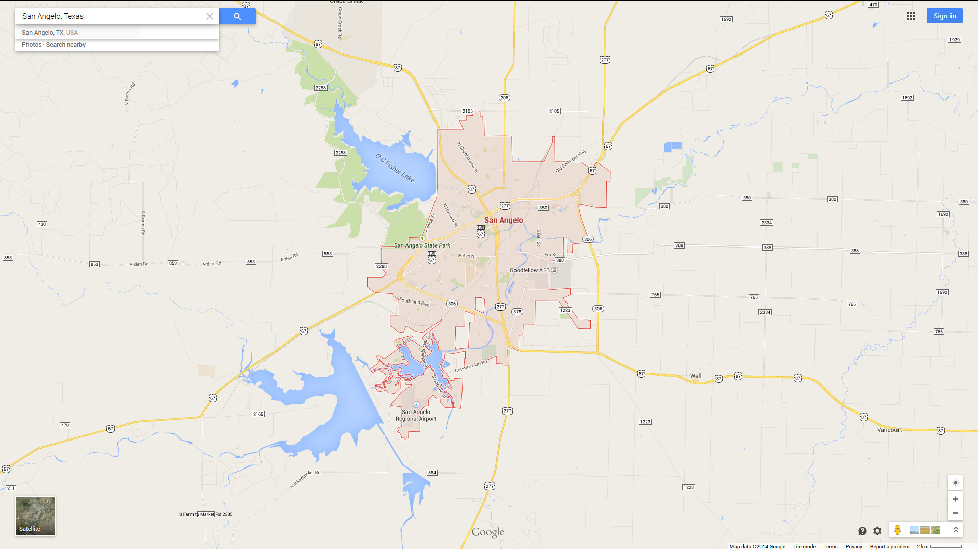
San Angelo Texas Map
Navigate San Angelo, Texas Map, map of San Angelo, San Angelo Texas regions map, San Angelo satellite image, towns map, road map of San Angelo.
Texas Map
States Map of USA
Where is Texas in the US and Cities Map of Texas
Please subscribe on "World Guide" channnel on Youtube at youtube.com/c/WorldGuide
Map of San Angelo Texas, Texas
san angelo texas map usa

Map of San Angelo
SAN ANGELO TEXAS MAP USA

SAN ANGELO MAP TEXAS US

SAN ANGELO MAP TEXAS US SATELLITE

SAN ANGELO TEXAS HIGHWAY AND ROAD MAP WITH SATELLITE VIEW

SAN ANGELO TEXAS HIGHWAY AND ROAD MAP

Largest Texas Cities by Population
Houston Map San Antonio Map Dallas Map Austin Map Fort Worth Map El Paso Map Arlington Map Corpus Christi Map Plano Map Laredo Map Lubbock Map Garland Map Irving Map Amarillo Map Grand Prairie Map Brownsville Map Pasadena Map Mesquite Map McKinney Map McAllen Map Killeen Map Waco Map Carrollton Map Beaumont Map Abilene Map Frisco Map Denton Map Midland Map Wichita Falls Map Odessa Map Round Rock Map Richardson Map Tyler Map Lewisville Map College Station Map The Woodlands Map San Angelo Map Pearland Map Allen Map League City Map Longview Map Sugar Land Map Edinburg Map Mission Map Bryan Map Baytown Map Pharr Map Missouri City Map Temple Map Atascocita Map Harlingen Map Flower Mound Map North Richland Hills Map Victoria Map New Braunfels Map Mansfield Map Conroe Map Rowlett Map Spring Map Port Arthur Map Euless Map South Houston MapFor all Texas Cities Map
San Angelo Texas Google Map, Street Views, Maps Directions, Satellite Images
GuideoftheWorld.net offers a collection of San Angelo Texas map, google map, San Angelo Texas atlas, political, physical, satellite view, country infos, cities map and more map of San Angelo Texas.
US States by Population
California Map Texas Map New York Map Florida Map Illinois Map Pennsylvania Map Ohio Map Michigan Map Georgia Map New Jersey Map North Carolina Map Virginia Map Massachusetts Map District of Columbia Map Indiana Map Tennessee Map Arizona Map Missouri Map Maryland Map Washington Map Minnesota Map Colorado Map Alabama Map Louisiana Map South Carolina Map Kentucky Map Oregon Map Oklahoma Map Connecticut Map Iowa Map Mississippi Map Arkansas Map Kansas Map Utah Map Nevada Map New Mexico Map West Virginia Map Nebraska Map Idaho Map Maine Map New Hampshire Map Hawaii Map Rhode Island Map Montana Map Delaware Map South Dakota Map Alaska Map North Dakota Map Vermont Map Wisconsin Map Wyoming MapCopyright GuideofTheWorld.Net 2006 - 2025. All rights reserved. Privacy Policy | Disclaimer

